History of Hadoti
The city of Jhalawar
is situated in the
south-eastern region of
Rajasthan, a region
widely known as Hadoti
(Hadavati), the land of
Hadas. The Hadas are a
major branch of the
great Chauhan clan of
Agnikula Rajputs. In the
12th century A.D., Hada
Rao Deva conquered this
territory and founded
Bundi state and Hadauti.
Later in the early 17th
century A. D. during the
reign of Mughal emperor
Jahangir, the Ruler of
Bundi, Rao Ratan Singh
gave the smaller
principality of Kota to
his son, Madho Singh,
but when Sahajahan
became the emperor, he
issued a Farmaan in the
name of Madho Singh,
recognizing as him the
King of Kota. The domain
of the Hadas of Bundi
and Kota extended from
the hills of Bundi in
the west to the Malwa
plateau in the east,
with a similar expense
from north to south. The
State of Jhalawar was
founded on 8 April,
1838, out of the Kota
territory. Jhalawar
state got rise as a
result of a treaty
between English rulers,
Kota state, and Malwa
state.
District Profile :
The Princely State of
Jhalawar was created in
1838 A. D. after being s
eparated from Kota by
the British. It got its
name derived from
Jhalas, the Jhala clan
of Rajputs, also the
rulers of Jhalawar.
Lying in the
south-eastern region of
Rajasthan at the edge of
the Malwa plateau,
Jhalawar has rocky, but
water-laden verdant
landscape, unlike much
of the Rajasthan.
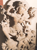
With some exquisite
pre-historic cave
paintings, massive
forts, thickly-wooded
forests and exotic
wildlife variety,
Jhalawar boasts of rich
historic as well as
natural wealth.
Jhalawar region has an
exotic flavor with its
diverse range of flora
and fauna, with which it
is richly-blessed. Red
poppy fields add to the
vibrant color, while the
saras crane breeding
grounds spotlight the
rich avian life
dominating Jhalawar
territory.
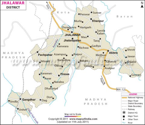
Total area of the
district is 6928 km2.
Around 21% of this area
is forest area. Total
length of tarred roads
is around 1400 Km., out
of which 94 kms. come in
National Highway range,
and 202 kms are in state
highway range.
District has 7
Sub-divisions, 7
Tehsils, 4 Sub-Tehsils,
and 6 Blocks. Total
revenue villages in the
district are 1618.
Demographics
As of 2001 India
census,[2] Jhalawar had
a population of 48054.
Males constitute 53% of
the population and
females 47%. Jhalawar
has an average literacy
rate of 71%, higher than
the national average of
59.5%: male literacy is
78%, and female literacy
is 63%. In Jhalawar, 15%
of the population is
under 6 years of age.
Mini Secretariat,
Jhalawar
Geography :
Jhalawar is located at
24°36′N 76°09′E24.6°N
76.15°E.[1] It has an
average elevation of 312
metres (1023 feet).
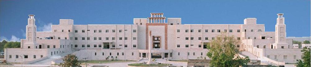
Education
Jhalawar has a
well-developed
educational structure,
providing higher
education, including an
engineering college as
well as a medical
college.
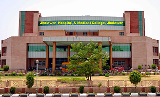
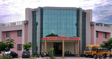
Jhalawar Hospital &
Medical College
Places to see
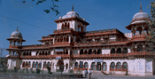 |
 |
 |
|
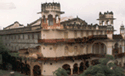
Jhalawar
fort (Garh Palace) |
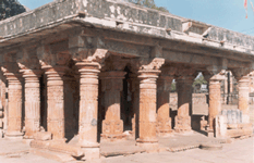
Government Museum |
Bhawani
Natyashala |
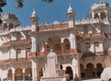
 |
 |
 |
|
Bhawani
Natyashala |
Rein Basera |
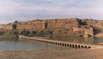
Jhalarapatan- Gagron
fort |
 |
 |
.jpg) |
|
Chandrabhaga
temple |
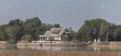
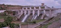
Bhimsagar
Dam |
Dalhanpur,
Chhapi Dam |